
Ecotourism is reshaping how we explore nature, blending adventure with conservation to protect wildlife while satisfying our wanderlust for authentic encounters.
🌿 The Rising Need for Wildlife-Conscious Trail Design
As global ecotourism revenue surpasses $180 billion annually, the pressure on natural habitats intensifies. Traditional trail planning often overlooks the intricate behavioral patterns of wildlife, leading to habitat fragmentation, increased stress in animal populations, and disrupted breeding cycles. The modern traveler craves immersive natural experiences, but without thoughtful path planning, our footsteps can leave lasting scars on the ecosystems we wish to celebrate.
Wildlife wanderlust represents a paradigm shift in how we design ecotourism experiences. It acknowledges that sustainable tourism isn’t just about minimizing human impact—it’s about actively creating pathways that respect animal territories, migration routes, and seasonal patterns. This approach requires sophisticated understanding of animal behavior, terrain analysis, and visitor management strategies that balance accessibility with conservation imperatives.
The challenge lies in creating trails that satisfy human curiosity while ensuring wildlife can maintain their natural rhythms undisturbed. Research from conservation biologists indicates that poorly planned trails can alter animal movement patterns up to five kilometers from the path itself, creating ripple effects throughout entire ecosystems.
🦁 Understanding Animal Behavior in Trail Planning
Effective eco-friendly trail design begins with comprehensive wildlife monitoring. Before a single shovel breaks ground, conservation teams must document species presence, movement corridors, feeding areas, and breeding grounds throughout different seasons. This biological baseline informs every subsequent decision in the planning process.
Large mammals like elephants, bears, and big cats require extensive territories and are particularly sensitive to human presence. Trail planners must identify and avoid core habitat areas while potentially creating carefully managed observation zones at the periphery. These buffer zones allow visitors controlled access without penetrating critical wildlife spaces.
Migratory species present additional complexity. Birds, caribou, wildebeest, and marine animals follow ancient routes embedded in their genetic memory. Trails intersecting these pathways during migration periods can cause significant disruption, forcing animals into suboptimal habitats or dangerous detours. Seasonal trail closures and flexible routing become essential management tools.
Nocturnal Wildlife Considerations
Many ecosystems come alive after dark, with nocturnal species accounting for significant biodiversity. Trail design must consider how human activity during daylight hours affects animals that rest during the day and hunt at night. Light pollution from facilities, noise residue, and scent markers all persist beyond visitor hours, potentially disturbing these critical species.
Advanced trail planning incorporates temporal zoning—designating when and where human access occurs to minimize overlap with sensitive wildlife activity periods. Some trails may remain open only during specific hours or seasons, while others incorporate one-way systems that reduce encounter frequency and predictability for animals.
📍 Technology Enabling Smarter Path Planning
Geographic Information Systems (GIS) have revolutionized wildlife-safe trail design. These platforms integrate multiple data layers—topography, vegetation, water sources, wildlife sightings, and human use patterns—creating comprehensive visualizations that reveal optimal trail locations. Planners can model different scenarios, predicting how proposed routes might affect animal movement and identifying potential conflict zones before construction begins.
Camera traps and GPS collar data provide unprecedented insights into animal behavior. By analyzing thousands of wildlife images and movement tracks, algorithms can identify preferred travel corridors, temporal activity patterns, and response behaviors to human presence. This empirical evidence replaces guesswork with data-driven decision making.
Drone technology offers landscape-scale perspectives, revealing terrain features and habitat connectivity invisible from ground level. Aerial surveys conducted across seasons document how ecosystems change throughout the year, informing adaptive trail management strategies that respond to these natural rhythms.
Real-Time Monitoring Applications
Mobile technology is transforming how trails are managed after construction. Real-time wildlife tracking systems can alert rangers when tagged animals approach visitor areas, enabling temporary closures or visitor redirections. These dynamic management systems acknowledge that wildlife doesn’t respect static boundaries, requiring flexible human responses.
Some conservation areas now employ visitor management apps that guide tourists along routes based on current wildlife locations, ensuring separation while maximizing viewing opportunities at safe distances. These platforms collect user data that further refines understanding of human-wildlife interaction patterns.
🛤️ Design Principles for Animal-Safe Trails
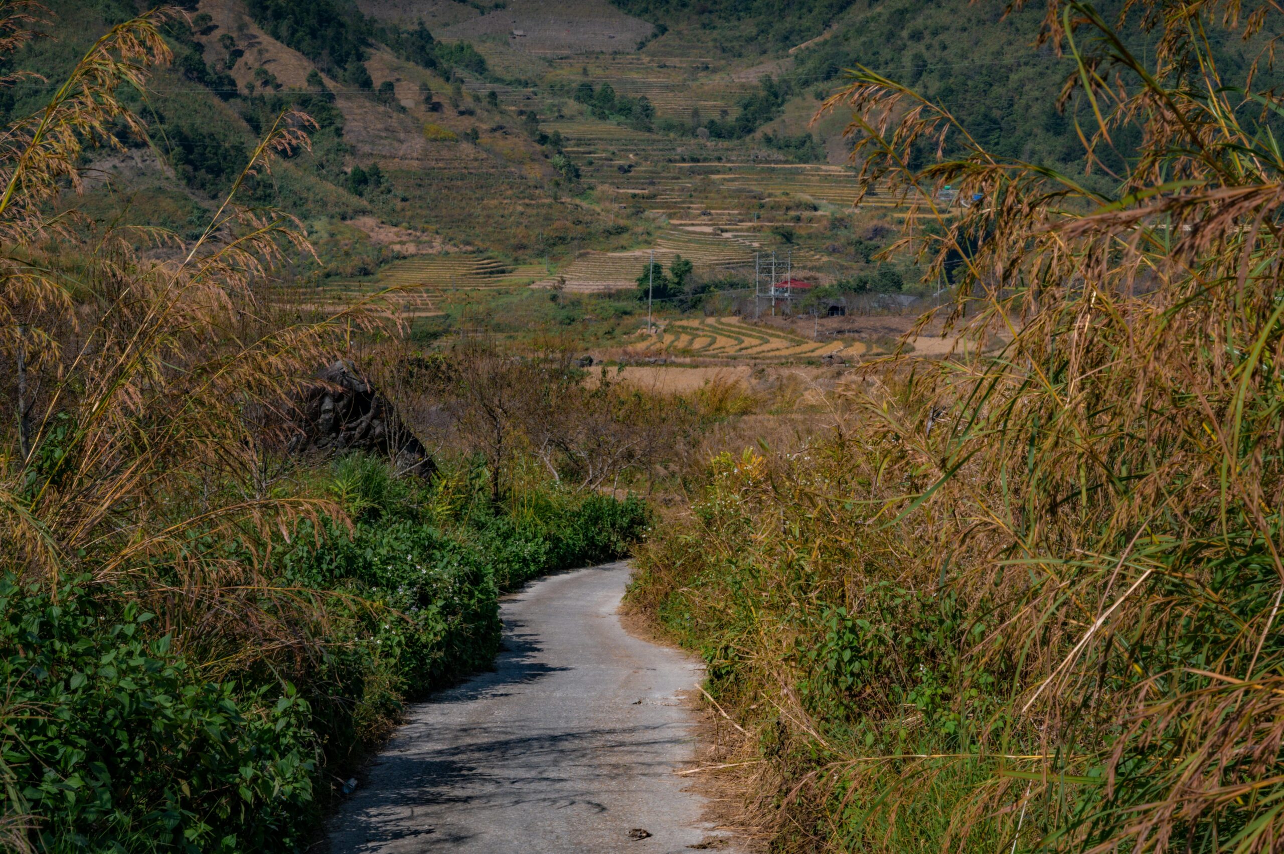
The physical characteristics of trails significantly influence wildlife behavior. Width, surface material, sight lines, and accessibility all affect how animals perceive and respond to these human corridors through their habitat.
Narrow trails minimize habitat fragmentation and feel less imposing to wildlife. Research suggests trails under two meters wide create less behavioral disruption than wider paths, though this must be balanced against safety considerations for visitors encountering potentially dangerous wildlife.
Surface materials matter more than many planners recognize. Natural surfaces blend into the landscape and allow water permeation, supporting vegetation and invertebrate communities. Hard surfaces create permanent barriers, alter drainage patterns, and generate noise that travels further through ecosystems.
Strategic Sightline Management
Vegetation screening along trails serves multiple purposes. Dense plantings reduce visual penetration, allowing animals to approach trails without detecting human presence from distance. This reduces stress responses and supports natural movement patterns. Paradoxically, some zones benefit from clear sightlines that allow both humans and animals to detect each other from safe distances, preventing dangerous surprise encounters.
Curves and topographic variation make trails less predictable for wildlife, reducing the corridor effect that can fragment habitats into isolated patches. Meandering paths that follow natural contours feel more organic and provide continuous screening compared to straight-line routes.
🌍 Successful Ecotourism Trail Models Worldwide
Costa Rica’s cloud forest reserves demonstrate exemplary wildlife-conscious trail design. Elevated walkways and canopy bridges allow tourists to experience ecosystems at multiple vertical levels without trampling understory vegetation or disturbing ground-dwelling species. These structures create minimal footprint while providing spectacular wildlife viewing opportunities.
African safari operations increasingly employ vehicle-only routes with strictly enforced no-exit policies. These contained systems allow close wildlife encounters while preventing human scent and physical presence from permeating the landscape. Some operations employ electric vehicles, eliminating engine noise that can disrupt animal communication and hunting behavior.
Australia’s Great Ocean Walk incorporates seasonal closures protecting shearwater breeding colonies and seal pupping beaches. Interpretive signage explains these restrictions, transforming potential visitor disappointment into conservation education opportunities. This model demonstrates that exclusion, when properly communicated, can enhance rather than diminish the ecotourism experience.
Indigenous Knowledge Integration
Many of the world’s most biodiverse regions overlap with indigenous territories. Communities with millennia of landscape experience possess invaluable knowledge about animal behavior, seasonal patterns, and sustainable interaction practices. Progressive trail planning incorporates this traditional ecological knowledge alongside scientific research, creating more holistic and culturally sensitive designs.
In Canada’s Northwest Territories, indigenous guides design trails that respect traditional hunting areas and spiritual sites while providing visitors authentic cultural and wildlife experiences. This collaborative approach ensures economic benefits flow to communities while maintaining their traditional relationship with the land.
⚖️ Balancing Access with Preservation
The fundamental tension in ecotourism trail planning is democratizing nature access while protecting the very qualities that make destinations appealing. Too restrictive, and trails fail to generate the visitor revenue that funds conservation. Too permissive, and ecosystems degrade under human pressure.
Carrying capacity calculations provide scientific frameworks for this balance. By assessing ecological sensitivity, wildlife tolerance levels, and infrastructure capabilities, managers can establish visitor limits that maintain ecosystem integrity. These limits require enforcement mechanisms—permits, reservations, and guided-only access—that some visitors resist but prove essential for long-term sustainability.
Zonation strategies distribute human impact across landscapes rather than concentrating it in specific hotspots. Core wilderness areas remain off-limits except for research, while buffer zones accommodate low-impact activities, and designated visitor zones concentrate facilities and higher-intensity use. This gradient approach provides diverse experiences while protecting critical habitats.
The Economics of Sustainable Trail Systems
Wildlife-safe trail design typically requires higher initial investment than conventional approaches. Specialized surveys, advanced planning tools, and thoughtful construction techniques increase upfront costs. However, these investments yield long-term returns through sustained ecosystem health, reliable wildlife viewing, and enhanced visitor satisfaction.
Destinations that degrade through poor planning face declining visitation, negative reviews, and ultimately, economic collapse. The ecotourism industry relies on authentic wildlife experiences that disappear when animals abandon areas due to human disturbance. Proper trail planning becomes economic insurance, protecting the natural capital that drives visitor spending.
🔬 Monitoring and Adaptive Management Strategies
Trail planning doesn’t end at construction completion. Effective systems incorporate ongoing monitoring to assess how wildlife responds to human presence over time. Camera traps positioned along trails document species presence, abundance, and behavior changes that may indicate stress or habituation.
Vegetation monitoring reveals whether trail edges are expanding through informal visitor creation of side paths or shortcuts. Soil compaction measurements assess whether water drainage patterns have changed, potentially affecting plant communities and the animals dependent on them.
Visitor surveys provide the human perspective, documenting wildlife sighting frequencies, encounter types, and satisfaction levels. Declining sightings may indicate animals are avoiding areas, while increased conflict incidents suggest management adjustments are needed.
Adaptive Trail Management
The best trail systems embrace flexibility, evolving as new information emerges. Sections may require temporary or permanent closure if wildlife monitoring reveals problematic impacts. Routes might be adjusted, viewing platforms added, or visitor numbers reduced based on empirical evidence rather than assumptions.
This adaptive approach requires institutional commitment to long-term ecological monitoring and willingness to make unpopular decisions when conservation demands it. Transparent communication about why changes occur helps visitors understand they’re participating in dynamic conservation efforts rather than static park experiences.
🎓 Education as a Conservation Tool
Well-designed interpretive elements transform trails into outdoor classrooms, helping visitors understand why certain design features exist and how their behavior affects wildlife. Signage explaining seasonal closures, required distances from animals, and ecosystem sensitivities converts regulations from arbitrary rules into logical conservation measures.
Mobile apps enhance this educational mission, providing location-specific information about species present, ecological relationships, and conservation challenges. Interactive elements—identifying animal tracks, recording species sightings, or participating in citizen science—deepen engagement and foster conservation ethics.
Guided experiences with trained naturalists offer irreplaceable value, providing context that static signage cannot match. Guides interpret animal behavior in real-time, explain ecosystem complexities, and model appropriate visitor conduct. Their presence also enables enforcement of regulations in non-confrontational, educational ways.
🚀 The Future of Wildlife-Safe Ecotourism
Emerging technologies promise to further refine animal-safe trail design. Artificial intelligence analyzing wildlife camera footage can detect behavioral stress indicators invisible to human observers, providing early warnings of problematic human-wildlife interactions. Predictive modeling will enable managers to anticipate how climate change, wildlife population dynamics, and visitor trends will affect trail systems decades into the future.
Virtual reality may eventually satisfy some visitor desires without physical presence in sensitive habitats. While nothing replaces authentic nature experiences, VR could reduce pressure on the most fragile ecosystems while still providing meaningful wildlife encounters and generating conservation revenue.
The growing recognition that human wellbeing depends on healthy ecosystems is driving demand for ecotourism that genuinely protects nature rather than merely exploiting it. This awareness creates market incentives for destinations to invest in wildlife-safe infrastructure, demonstrating that conservation and tourism can be mutually reinforcing rather than inherently conflicting.
🌟 Creating Trails That Honor Wildlife First
The ultimate measure of ecotourism trail success isn’t visitor numbers or revenue generated—it’s whether wildlife populations thrive despite human presence. Trails designed with this priority become corridors of coexistence, demonstrating that humans can experience nature’s wonders without diminishing them for future generations.
This requires humility about our place in ecosystems, recognizing that we’re guests in wildlife’s home rather than owners of resources to exploit. It demands patience with planning processes that prioritize ecological research over rapid development. And it necessitates accepting limitations on where we go and when we visit based on wildlife needs rather than human convenience.
The rewards of this approach extend far beyond individual trail experiences. Wildlife-safe ecotourism creates constituencies for conservation, demonstrating to local communities that living animals have greater economic value than dead ones. It funds protected area management that benefits entire ecosystems. And it nurtures the human spirit through encounters with wildness that remind us we’re part of nature, not separate from it.
As we plan the trails of tomorrow, let’s design pathways that tread lightly, observe respectfully, and leave landscapes where wildlife continues to wander freely—exactly as nature intended. Our wanderlust need not come at nature’s expense when we plan with wisdom, implement with care, and visit with reverence for the remarkable creatures sharing our planet.


